Free Camping Near Bend, Oregon: A Practical Dispersed Camping Guide
Free Camping Near Bend, Oregon: A Practical Dispersed Camping Guide
Bend is an outdoor playground.
It is also very good at separating you from your money.
When Tortuga and I started planning our Oregon trip, we discovered that quickly.
A single room in a shared space around Bend was coming up around $1,400 for a week during our search.
That is not a typo.
We ended up basing out of Eugene and day-tripping east to Sisters instead — which turned out to be the better call anyway. But the Bend pricing still needed an explanation.
How does a high-desert logging town in central Oregon become one of the most expensive places to sleep in the Pacific Northwest?
The short answer: the same way every outdoor town becomes expensive.
First the loggers left. Then the skiers arrived. Then the cyclists. Then the trail runners. Then Instagram. Then, when COVID unlocked remote work, California arrived with cash and a U-Haul.
Before we get to the free camping, it’s worth understanding what Bend actually is — because that context changes how you plan an entire trip.
Bend Was Not Always Like This
The city takes its name from Farewell Bend — a bend in the Deschutes River where travelers on the Applegate Trail, an 1846 southern alternative to the Oregon Trail, took their last good look at the water before pushing west into the desert. A crossing point. A goodbye to the river.
The town didn’t incorporate until 1905.
What actually put Bend on the map was the railroad — except the railroad itself was a war.
In 1909, both James J. Hill (Great Northern Railway) and E.H. Harriman (Union Pacific) simultaneously sent survey crews and construction gangs racing up the narrow Deschutes Canyon to reach Bend first. Both companies built parallel tracks on opposite sides of the same river gorge — sometimes only yards apart — for nearly 100 miles through canyon walls with barely enough room for one line. There were physical confrontations between work crews. Blasting on one side sent rock onto the other. It was one of the most dramatic infrastructure rivalries in American history, and most people have never heard of it.
It ended in a negotiated stalemate: Hill’s Oregon Trunk Line won the race to Bend. Harriman’s Spokane, Portland and Seattle line ran on Hill’s tracks by agreement.
The railroad unlocked the timber.
Two enormous sawmills arrived around 1916 — Brooks-Scanlon and Shevlin-Hixon — and proceeded to systematically clear-cut the surrounding ponderosa pine forests over the next several decades. At their peak these operations dominated every aspect of local life. The mills set the schedules. The company stores set the prices. Bend existed in service to the timber.
Then the trees ran out.
Shevlin-Hixon closed in 1950. Brooks-Scanlon held on until 1994.
But between those two closures, something else had started.
Mt. Bachelor opened for skiing in 1958.
That is where the modern Bend begins.
Then California Arrived
Mt. Bachelor is 22 miles from downtown Bend. It has 4,300 skiable acres and 3,365 vertical feet, and it sits at the edge of the Cascades in a spot that gets serious snowfall while keeping the dry, sunny character of the high desert. You can ski powder in the morning and sit outside at a coffee shop in the afternoon without a jacket.
Skiers discovered it in the 1960s. Mountain bikers arrived in force by the 1980s. Trail runners, climbers, kayakers, and fly-fishing enthusiasts followed. By the time the last mill closed in 1994, Bend had already figured out what came next.
Then the tech workers figured out Bend.
Oregon has no income tax. No sales tax. Enormous public land. Outdoor recreation that most Western cities can only approximate. And through the 1990s and early 2000s, it was still genuinely affordable.
That changed.
The bumper sticker “Don’t Californicate Oregon” dates to the 1970s, when Governor Tom McCall famously invited out-of-staters to visit but urged them not to stay permanently. McCall had a point then. By the 2010s, the point was moot.
During COVID, remote work untethered a generation of California tech workers from their offices. Bend offered everything — outdoor lifestyle, no income tax, clear skies, trails out the back door — without the Bay Area rent. For a chaotic 18 months in 2020-2022, California buyers arrived in numbers that shocked even veteran Oregon transplants.
The median home price went from roughly $300,000 in 2015 to over $650,000 by 2022.
Airbnb listings extracted thousands of units from the long-term rental market. Locals who had rented for years found themselves priced out. Workers commute in from Redmond, Prineville, and La Pine now.
Bend has a population over 100,000 today. It has three hospitals, a university (OSU-Cascades), genuine traffic congestion on US-97, a Costco, and a Trader Joe’s.
The mountain town image and the boomtown reality coexist awkwardly. The western storefronts downtown look like a set from a film about the Old West. The coffee shop line looks like a film about a startup.
That tension is why the free camping question matters.
What You’re Actually Coming For
The expense would be easier to ignore if Bend weren’t genuinely extraordinary.
The thing people miss when they look at room rates and turn around is what they’re priced out of access to.
The volcanic landscape. The Cascade Range built itself in fire and is still building. Newberry Volcano, 25 miles south of Bend, last erupted approximately 1,300 years ago — younger than the Bede monastery in England, younger than the Lindisfarne Gospels. Its caldera holds two crater lakes (Paulina and East Lake), an obsidian flow you can walk across, and more than 400 miles of trails across 55,000 acres. Lava River Cave, just outside the monument boundary, is the longest uncollapsed lava tube in Oregon — over a mile of passage that stays at 42°F year-round. Even in July, your breath fogs. Bring a headlamp you trust.
Full Newberry National Volcanic Monument guide →
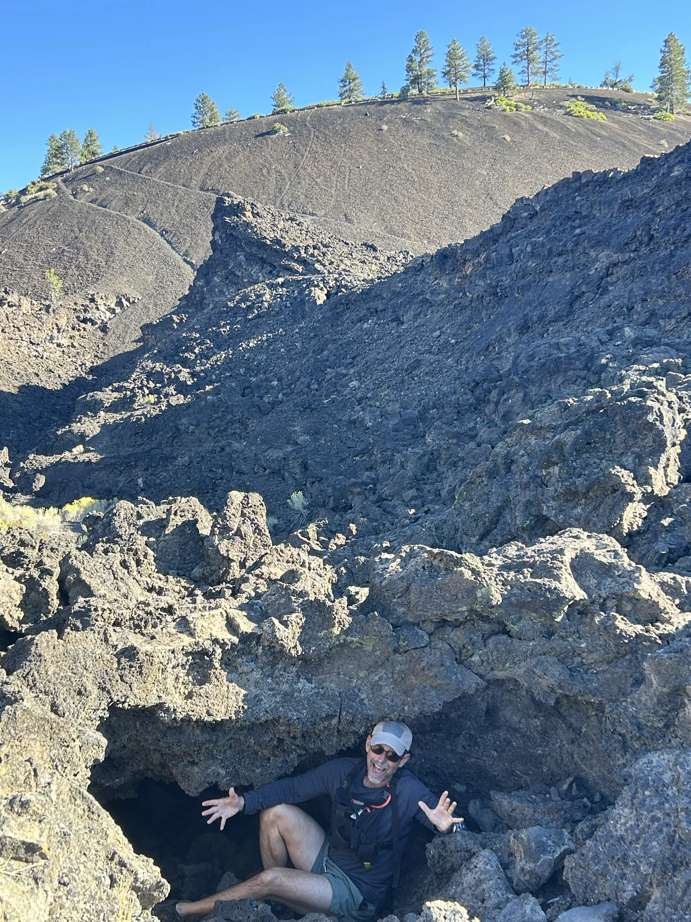
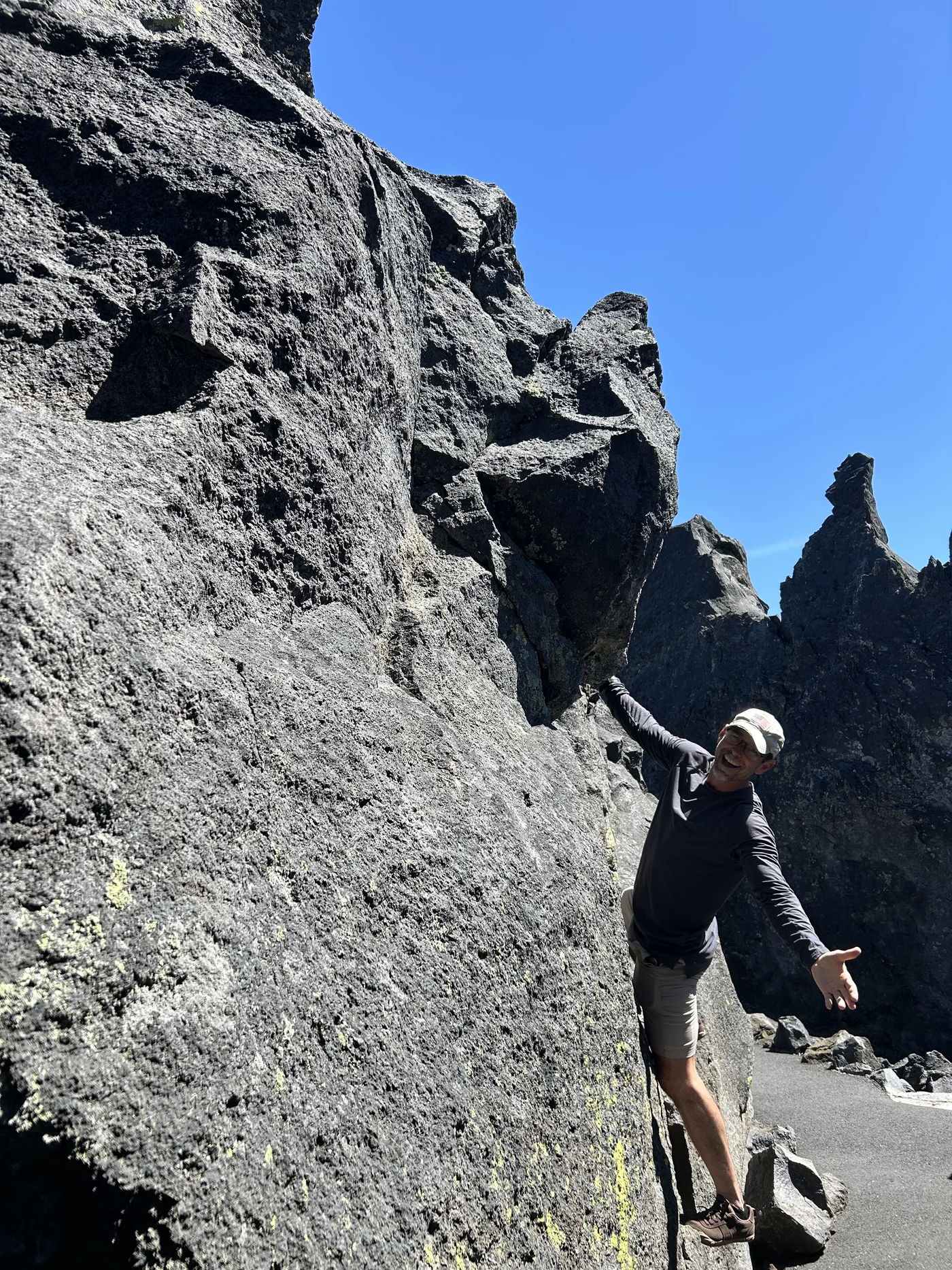
The lava fields at McKenzie Pass. West of Sisters, the Pacific Crest Trail crosses 9 miles of raw basalt lava from a flow approximately 1,500 years old — younger than the Islamic calendar, younger than the founding of Venice. The lava stopped where it stopped, the forest survived on either side, and the PCT walks you straight across the divide. The Dee Wright Observatory at the summit, built by the Civilian Conservation Corps in 1935 from the same lava rock it sits on, gives you a 360-degree view of what it looks like when a volcanic arc spends three million years building itself. Every one of the peaks visible from that rim is a Cascade volcano. Several are considered potentially active.
Standing at the Dee Wright Observatory and looking east at the Sisters, west at the lava field, south at Mt. Bachelor, and realizing the PCT hikers crossing the lava below you are walking on something that was liquid rock when the Vikings were raiding England — that is the kind of thing you don’t get at a resort.
Three Sisters Wilderness hiking and backpacking →
Smith Rock. Forty-five minutes north of Bend, a series of tuff and rhyolite columns rise 400 feet above the Crooked River. Smith Rock is where sport climbing in the United States was born in the 1980s — climbers like Alan Watts put up routes here that rewrote what American rock climbing looked like. Today the park sees climbers from every continent. The Monkey Face route is one of the most photographed climbs in the country. It’s a state park. $5 parking. If you want to sleep nearby without paying for a campground, Skull Hollow — a free USFS site southeast of the park — puts you in the same volcanic landscape. Skull Hollow
Cascade Lakes Scenic Byway. A 66-mile paved loop west and south of Bend passes 11 alpine lakes — Elk Lake, Sparks Lake, Devil’s Lake, Hosmer, Cultus — set below the Three Sisters, Mt. Bachelor, and Broken Top. Open from Memorial Day until snow closes it in fall. Free beaches at every stop. Kayak rentals at Elk Lake Resort if you need one.
Mountain biking. Bend consistently gets called the best mountain bike destination in the United States. The trail system is enormous — the Phil’s Trail complex starts literally at the edge of town and has occupied world-class riders for decades. Tumalo Falls Trailhead — 14 miles west of Bend — drops you into a network of hiking and mountain bike trails deep into the national forest, with the waterfall as your turnaround or your beginning. If you’re on a bike, you could spend two weeks here and not repeat a trail.
The river. The Deschutes River runs through downtown, with swimming holes, kayaking and a riverside park system that makes the city actually usable in a way that many outdoor towns forget. South of town, Benham Falls / Deschutes River Trail is the best single access point — a short walk to a viewpoint over Benham Falls, with miles of river canyon trail in either direction. The same river that gave the town its name still organizes everything around it. Oregon swimming holes →
The sun. Bend averages over 300 sunny days per year — technically more than Miami. The Cascades block Pacific weather systems; Bend sits in the rain shadow behind the range. That’s why the ponderosa pine survived the moisture gradient, why the high desert rolls right up to the mountains, and why people who move here from the coast start sounding evangelical within six months.
The breweries. Deschutes Brewing opened in 1988 and helped seed what is now one of the densest craft beer concentrations in the country. Bend has more than 30 breweries for a city of 100,000. You won’t go thirsty.
All of this is within an hour of wherever you camp on Deschutes National Forest land.
Which brings us back to the free camping question.
But Here’s the Word “Free” With Its Asterisk
There is dispersed camping on public land around Central Oregon, particularly in Deschutes National Forest.
But you cannot simply pull onto any dirt road outside Bend, park wherever you want, and declare yourself a homesteader.
There are stay limits.
Closures.
Fire restrictions.
Areas where dispersed camping is prohibited.
Roads where motorized travel is restricted.
And some historically popular camping areas near Bend have changed significantly in recent years.
So let’s do this correctly.
What Is Dispersed Camping?
Dispersed camping means camping outside a developed campground on public land where camping is legally allowed.
Usually that means:
No campground host.
No reserved site.
No picnic table.
No hookups.
No shower.
Often no toilet.
And usually no fee.
You trade amenities for freedom and simplicity.
For us, that can be a fantastic setup.
Our long-term dream for the revived VW Vanagon is basically to use it as a mobile trail-running base camp: dogs, running gear, food, water, somewhere to sleep and somewhere comfortable to return after spending the day on trail.
Central Oregon is exactly the kind of landscape where that makes sense.
Is Dispersed Camping Allowed in Deschutes National Forest?
Generally, yes.
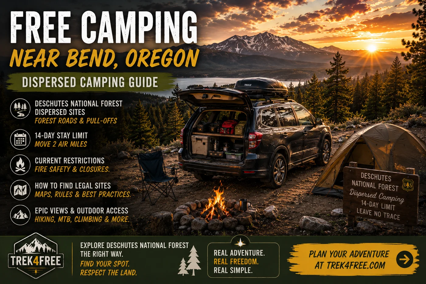
The Forest Service states that camping on Deschutes National Forest lands is generally allowed for a maximum of 14 days in developed or undeveloped camping areas.
After reaching that limit, campers must move at least two air miles before continuing to camp.
That does not mean every acre is open.
Specific closure orders, recreation sites, sensitive areas and local restrictions can override the general rule.
Always check the current Deschutes National Forest alerts and closure orders before choosing a site.
Important: Don’t Use an Old “Free Camping Near Bend” List Blindly
This is probably the most important part of this guide.
The camping situation around Bend changes.
One famous example is the China Hat / Cabin Butte area southeast of Bend — off Highway 97, not to be confused with Arnold Ice Cave Road which runs due south.
Historically, countless websites and forum posts recommended the China Hat Road corridor for dispersed camping.
That area has seen significant closures and management changes — forest restoration, wildfire-risk reduction, cleanup of long-term encampments — and portions remain affected.
So if you find a five-year-old blog post that simply says:
“Just drive down China Hat Road!”
Don’t — at least not without checking the current Deschutes National Forest closure map first. The situation in that specific corridor has changed.
The road corridors to the southwest (Arnold Ice Cave Road, Cascade Lakes Highway) are different and have their own current status you’ll need to verify separately.
Public-land information ages badly.
We want Trek4Free guides to help you avoid learning that at a locked gate.
Where Should You Look Instead?
Rather than publishing a handful of “secret coordinates” that eventually become trashed or closed, we think the better approach is to show you how to find a legal site yourself — so you’re not dependent on a blog post that was written three years ago.
The Deschutes National Forest surrounds the Bend / Sisters / La Pine region and contains a huge network of Forest Service roads where dispersed camping is generally allowed. On the Explore map, switch to USGS Topo layer — that shows you the land ownership boundaries so you’re not guessing. The green lines are the national forest boundary. If your proposed campsite is inside that boundary, on a dashed road line, you’re in the right territory.
What you’re looking for:
- National Forest land where dispersed camping is permitted.
- A road legally open to your vehicle.
- An existing campsite on durable, previously disturbed ground.
- A location outside any active closure.
- A way in and out without damaging the land.
Know whose land you’re standing on. Private property and National Forest land can sit surprisingly close together in Central Oregon — the map shows you the difference.
General Areas to Research
Instead of promising that one exact pullout will still be legal when you arrive, we’d investigate the broader public-land corridors around:
West and Southwest of Bend
Deschutes National Forest extends into the Cascade foothills west and southwest of Bend.
This puts you closer to mountain-bike trails, Cascade Lakes country and higher-elevation recreation.
However, the west Bend trail network can have active vegetation-management closures, including areas around popular trailheads.
Check current alerts.
Toward Sisters
If your goal is trail running, mountain biking and exploring Sisters Country, consider shifting your search north rather than insisting on sleeping five minutes from downtown Bend.
We fell in love with Sisters. The vibe is what people imagine Bend used to be — small, purposeful, surrounded by mountains, with a coffee shop that doesn’t have a 45-minute line.
The Sisters Ranger District contains extensive National Forest land and a huge trail network — including the Peterson Ridge Trail system, which practically starts in town.
For us, this is arguably more interesting than camping close to Bend just because Bend has the famous name.
The specific spots we know are real:
Peterson Ridge Dispersed Camping — On Three Creek Road at the NF-1605/NF-4606 intersection, just south of Sisters (44.2699°N, 121.5472°W). When Polly ran the Peterson Ridge Trail, she spotted people actively camping in ponderosa forest right off the road. Established sites, flat ground. The Peterson Ridge Trailhead — with a compost toilet — is about a quarter mile north, making this one of the most practical dispersed camping spots near Sisters. Deschutes National Forest land, 14-day limit, no water, pack in pack out.
Three Creeks Lake Road Dispersed — Further south along Three Creeks Lake Road into the FS 4606 corridor (approximately 44.208°N, 121.615°W). More dispersed sites scattered through ponderosa forest as you head toward Three Creek Lake. Popular with trail runners and mountain bikers. Same rules: 14-day limit, no water, no toilets at the sites themselves. Check current closures with the Sisters Ranger District before committing.
Both locations are in our Oregon free camping directory:
Peterson Ridge Dispersed Camping → | Three Creeks Lake Road Dispersed →
Or find them on the map: Trek4Free explore map →
South Toward La Pine
The country south of Bend toward La Pine gives access to large areas of Deschutes National Forest and puts you closer to Newberry National Volcanic Monument.
If Newberry, Paulina Lake, Lava River Cave or volcanic trails are the purpose of your trip, camping south of Bend can make far more sense than commuting from the north side of a city with actual traffic problems.
But note an important restriction:
Dispersed camping is prohibited inside Newberry Caldera.
Use developed campgrounds where required inside the monument and look for legal dispersed opportunities on the National Forest land outside restricted areas.
Specific spots in this corridor:
Arnold Ice Cave Road Dispersed Camping — Right at the southern edge of Bend where Arnold Ice Cave Road (Forest Road 18) crosses into Deschutes National Forest. This is the first legal free camping south of the city limits — paved road access, no services, 14-day limit. The same road leads to Arnold Ice Cave (a self-guided lava tube with ice formations that persist through summer) and continues toward Lava River Cave, the longest uncollapsed lava tube in Oregon.
Arnold Ice Cave Road Dispersed Camping →
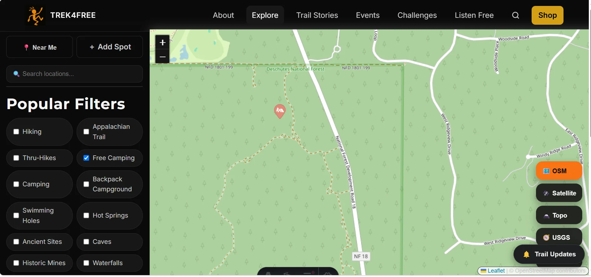
Paulina-East Lake Road Dispersed Camping — On the forest road southwest of La Pine that leads toward Newberry, outside the caldera boundary. Good base for Paulina Lake, East Lake, and Newberry trails without the in-monument camping prohibition. No water, no toilets, pack in/pack out, 14-day limit.
Paulina-East Lake Road Dispersed Camping →
How We Find a Dispersed Campsite
We built a tool for this.
Step 1: Open Trek4Free Explore
Turn on the Free Camping filter. Every verified free camping data point we have — dispersed sites, forest road camps, BLM spots — shows up as a marker on the map.
Then switch the map layer to USGS Topo. That layer shows terrain, elevation lines, and — critically — land ownership boundaries. The green boundary lines show you exactly where national forest begins. Oregon has private timberland, ranches, state land, BLM land, and national forest all mixed together. Trees don’t tell you who owns the ground under them. The topo layer does.
You can find the markers in this article — Arnold Ice Cave Road, Paulina-East Lake Road, and others — directly on that map. Zoom in, check the boundary, see the terrain.
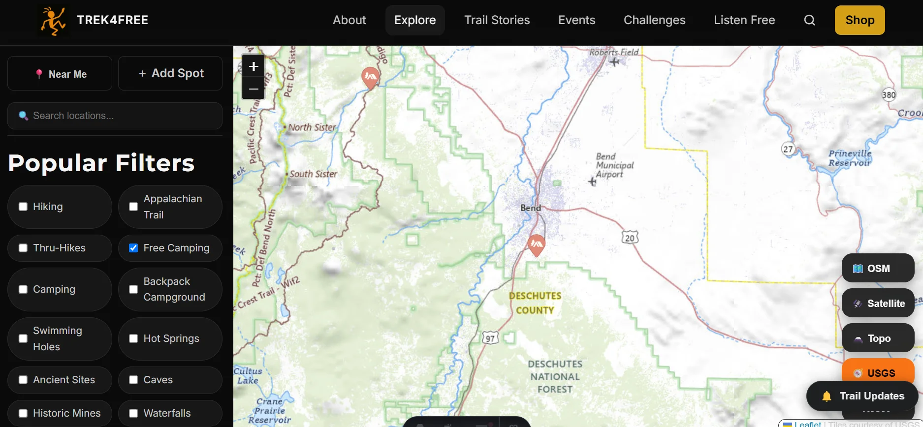
This is why we built it.
Step 2: Verify Current Alerts Before You Go
Once you’ve identified a spot on the map, check the current closure status before you leave home.
Wildfire. Forest restoration. Road work. Seasonal restrictions. Temporary closures.
Conditions around Bend change. The specific corridor you want may have a current order we don’t know about yet. Check the Deschutes National Forest alerts page before committing. Then check again when you’re within cell range of the area.
Our data tells you where the spots are. The Forest Service tells you which ones are currently open.
Step 3: Use an Existing Site
If you find an obvious previously used campsite on durable ground, use it.
Don’t bulldoze your own new campsite into vegetation because you wanted a better angle for photos.
Step 4: Have a Backup
Popular areas fill.
Roads wash out.
Gates close.
Fire restrictions change.
Someone may already be in the site you found.
Have Plan B. And preferably Plan C.
The 14-Day Rule Is Not a 14-Day Homestead Permit
The Forest Service’s 14-day maximum is a stay limit, not permission to establish a permanent camp.
When you leave, your stuff leaves.
Trash leaves.
Food leaves.
Camping equipment leaves.
Everything.
The goal is for the next person to wonder whether anyone camped there at all.
Campfires: Assume Nothing
Central Oregon is wildfire country.
We experienced the reality of that on our trip. On our final day, Prineville was filled with heavy smoke from regional wildfire activity. Later, as we headed toward Mount Hood, changing winds gave us much clearer views.
Fire conditions can vary enormously over short distances.
During fire season, campfire restrictions may prohibit fires even where you see an old fire ring.
An existing ring is not proof that today’s fire is legal.
Check current restrictions.
If you’re unsure?
Don’t light it.
Water
Dispersed camping does not mean a magical Forest Service faucet appears beside your van.
Bring water.
For vehicle camping, we’d rather carry too much than spend our evening driving back into Bend because somebody underestimated how much two humans and two dogs drink after a long trail run in the ponderosa sun.
Treat natural water before drinking it.
Bathrooms: This Is the Part Instagram Skips
Dispersed camping generally means no toilet.
Know current human-waste rules for the area you’re visiting and carry the equipment to comply with them.
High-use areas around Bend can have stricter waste requirements.
If dealing responsibly with human waste sounds unbearable, there is no shame in using a developed campground.
Sometimes paying for a toilet is money extremely well spent.
One good sign: the Peterson Ridge Trail system near Sisters has compost toilets at several parking areas throughout the network, which makes camping in that corridor considerably more practical than most dispersed areas.
Dogs and Van Camping
This is a major reason we keep dreaming about getting our VW Vanagon fully sorted.
A van makes an incredible trailhead base.
But don’t assume a parked van is automatically safe for dogs.
Central Oregon mornings can be genuinely cold. Afternoons can warm dramatically. Direct sun heats a vehicle quickly even when the outside temperature feels mild.
For any future Tortuga-and-Polly dog base camp, we’d want serious ventilation, shade, temperature monitoring and a climate plan appropriate to the conditions.
If the van can’t remain safely cool?
The dogs don’t stay inside while we run.
Simple.
Leave No Trace Isn’t Optional
Free camping works only if we don’t destroy the thing making it possible.
Pack out trash.
Use existing sites.
Don’t cut live vegetation.
Respect closures.
Manage human waste correctly.
Keep food secured.
Don’t create giant fire rings.
Don’t leave furniture.
Don’t dump tanks.
Don’t abandon vehicles.
And please don’t be the reason the next version of this article has a paragraph beginning:
“This area used to allow camping…”
Is Free Camping Near Bend Worth It?
For the right traveler?
Absolutely.
If you have a self-contained vehicle, enjoy primitive camping and would rather spend your money on trail time than hotel rates, Central Oregon public land is an extraordinary resource.
But don’t choose dispersed camping merely because Bend lodging made you angry.
If you need a shower every morning, reliable Wi-Fi, a toilet ten feet away and somewhere to plug in six devices?
Find a campground or a room.
There is no medal for making vacation unnecessarily miserable.
The Trek4Free Take
Our Oregon trip taught us that the best base isn’t always the most famous town.
We originally obsessed over Bend. Then Eugene became our practical base. Then Sisters stole our hearts. Then Newberry sent us running through lava country.
Bend is real and worth it. The volcanic landscape, the trails, the river, the sun — these are not hype. But you don’t have to sleep inside the city limits to access any of it.
Sisters trails? The Peterson Ridge Dispersed Camping right off Three Creeks Lake Road is the real answer — 100 yards south of the PRT trailhead compost toilet, ponderosa pines, legal Deschutes NF land, and you wake up beside one of the best trail networks in Central Oregon. We’ve seen people camped there. It works.
Newberry and the lava? The Arnold Ice Cave Road Dispersed Camping spot is right at the Bend city edge on the same road corridor as Arnold Ice Cave and Lava River Cave — the closest you’ll sleep to the lava tube network. For the Newberry-south approach: Paulina-East Lake Road Dispersed Camping, outside the caldera boundary.
Smith Rock? You’re looking at Terrebonne or the BLM land north of the park. Or just drive 45 minutes from a Sisters camp.
Cascade Lakes? Set up camp on the western forest roads. Wake up with the Sisters and Bachelor in view.
The point isn’t to camp beside Bend.
The point is to wake up somewhere legal, beautiful and useful for the adventure you came to have.
That’s a much better definition of a free campsite than a Bend hotel at $1,400 a week.
Find these sites and more on our explore map →
Sisters trail running guide → | Peterson Ridge Trail guide → | Newberry National Volcanic Monument guide →
Before You Go
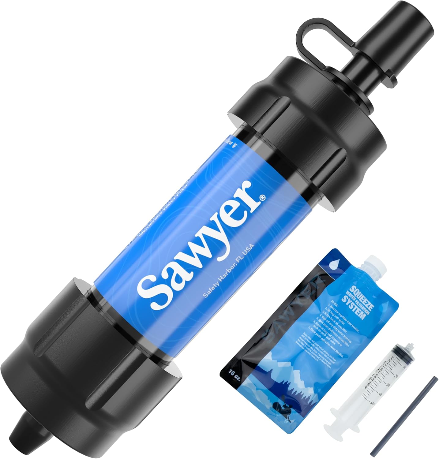 Sawyer Mini Water Filter
No water hookup at dispersed sites. Carry what you need and treat anything from natural sources. This filter is 2 ounces. There's no good reason not to have one in the pack.
Sawyer Mini Water Filter
No water hookup at dispersed sites. Carry what you need and treat anything from natural sources. This filter is 2 ounces. There's no good reason not to have one in the pack.
 Coast WPH20R Headlamp
Lava River Cave is a mile of unlit tube at a constant 42°F — this is the headlamp you actually want down there, not a phone flashlight. Also doubles as camp lighting once the sun drops behind the Cascades.
Coast WPH20R Headlamp
Lava River Cave is a mile of unlit tube at a constant 42°F — this is the headlamp you actually want down there, not a phone flashlight. Also doubles as camp lighting once the sun drops behind the Cascades.
Trip Planning
These are affiliate links — we appreciate your support, no extra cost to you.
Planning Sources