Peterson Ridge Trail Guide: Trail Running From Sisters, Oregon

Peterson Ridge Trail Guide: Trail Running From Sisters, Oregon
Peterson Ridge Trail starts at the edge of Sisters, Oregon.
Not at a trailhead you reach after forty minutes on a forest road.
Not behind a permit gate with a lottery.
Not at a lot that fills by 7am.
Half a mile south of Main Street — the ponderosa opens up and keeps going for more than twenty miles.
Tortuga found it on our first afternoon in Sisters.
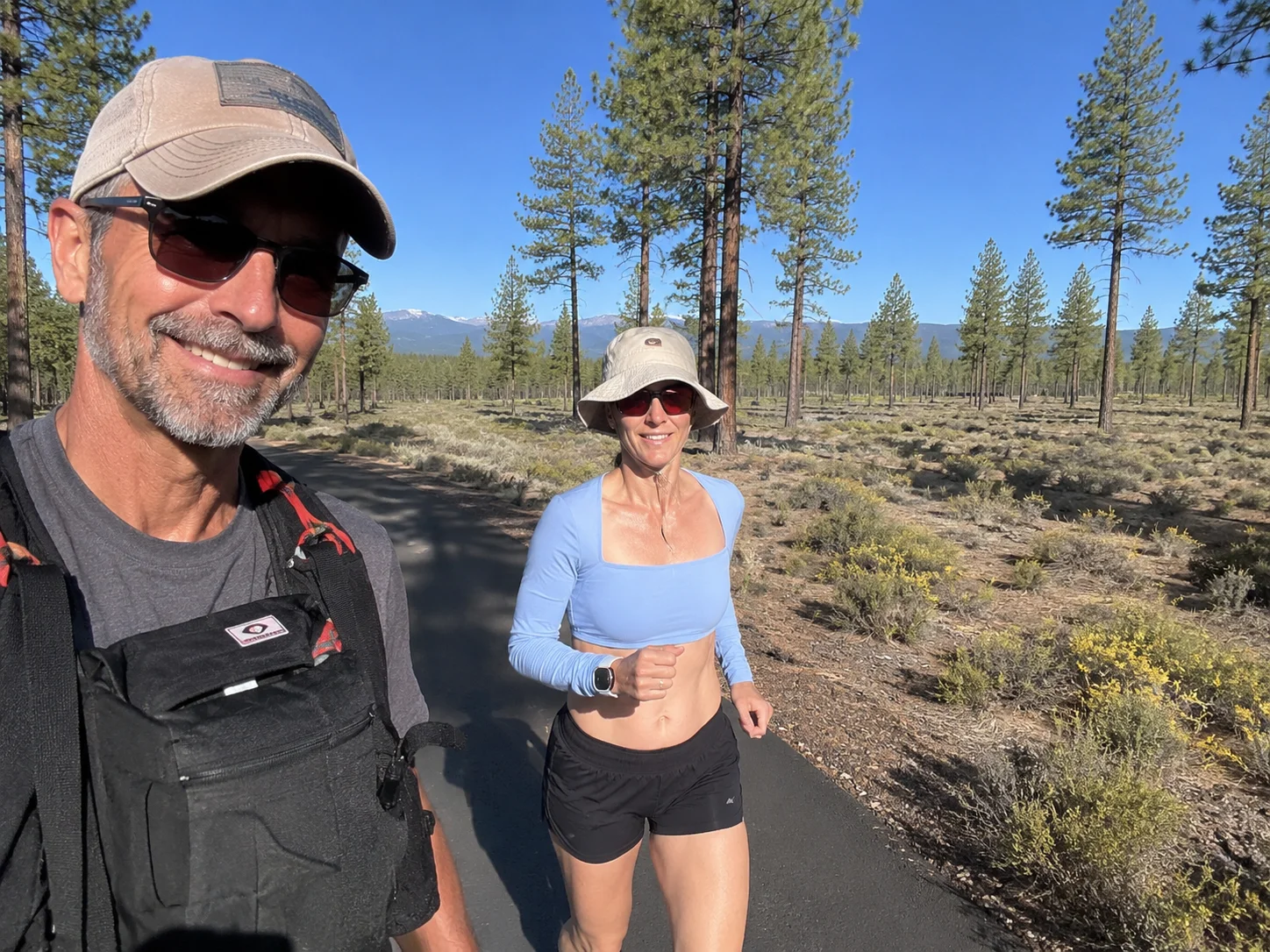
Running shoes were on approximately four minutes later. Polly runs in Joomra barefoot trail shoes — zero drop, wide toe box, built for exactly this kind of dry-side Oregon singletrack.
If you’re looking for Peterson Ridge Trail running, hiking or mountain biking, this is one of the easiest systems to recommend in Central Oregon because it practically starts in town — and has been doing exactly that since 1989.
What Is the Peterson Ridge Trail System?
Peterson Ridge Trails — shortened to PRT — is a network of dirt singletrack and Forest Service roads immediately south of Sisters, Oregon on the east slope of the Cascades in Deschutes National Forest.
The trail system was established in 1989 and has been expanded and maintained by the Sisters Trails Alliance ever since. A major expansion in 2008 added signage, trail markers, and pushed the network to its current scale: over 20 miles of singletrack — one of the most complete trail systems accessible directly from a mountain town in Central Oregon.
What makes PRT unusually useful is the ladder layout: east and west legs run parallel south from Sisters, connected by shorter cross-trails at intervals. That means you choose your distance while you’re running, not at the breakfast table.
Want three miles? Take a connector and come back.
Want sixteen? Keep going south.
That flexibility is exactly what we wanted as travelers who didn’t know the trail yet.
Getting There: The Trailhead
The main Peterson Ridge Trailhead is roughly half a mile south of downtown Sisters, just south of the Whychus Creek bridge on the edge of town. No long drive. No forest road navigation. Walk out of town, turn south, and you’re there.
Peterson Ridge Trailhead on Trek4Free →
There is a compost toilet at the trailhead — which matters more than it sounds. Most dispersed camping areas and dry-side Oregon trails don’t have facilities. PRT starts with one.
Parking at the main trailhead is limited. The Sisters Trails Alliance recommends Village Green Park as an overflow option with more parking and restroom access. Additional entry points exist farther south along Three Creek Road where the trail system crosses Forest Service roads.
For us, the best part wasn’t the parking logistics.
It was realizing that this much dirt existed immediately beside town.
What Is Peterson Ridge Like to Run?
Fun.
That’s the technical term.
PRT runs through the dry ponderosa forest typical of the Sisters side of the Cascades — the eastern rain shadow of the Oregon Cascades, where the trees thin out and the air dries out and the volcanic terrain starts showing through.
The system is rolling rather than brutal. Long sustained climbs are not the point here. You’re working with consistent movement, directional choices at junctions, and terrain that lets you actually run rather than power-hike uphill for most of the day.
That said: don’t let “rolling” mean sidewalk. You’re on dirt. There are rocks. Roots. Turns. Small climbs. Mountain bikes. Other people. Dogs. The kind of trail where staring at the scenery instead of your footing will send you stumbling.
For trail runners, that makes PRT wonderfully runnable. You can settle into a rhythm and cover real mileage in a way that steep alpine routes don’t allow.
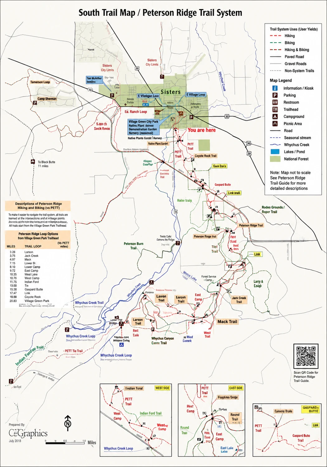 Map: Sisters Trails Alliance / C2Graphics. Download the 2026 official trail map PDF →
The Peterson Ridge Overlook Route
If you want a defined objective, the Peterson Ridge Overlook route is the classic starting point.
Distance: 10.6 miles
Elevation gain: 521 feet
Difficulty: Easy to moderate
Surface: Mostly dirt singletrack with some Forest Service road
That is a very attractive trail-running profile for a first visit. Enough mileage to feel like you did something. Enough climbing to keep it honest. But not a sufferfest.
The overlook gives you actual views — ponderosa country extending south, and on clear days, the Three Sisters sitting directly on the horizon.
The Long Loop
When you want more, the PRT Long Loop runs roughly 14.6 to 16 miles depending on the mapped version, with around 800 feet of elevation gain.
Same ladder system. More of it. The east and west legs give you options at every connector, so you can still adjust mileage mid-run if your legs or schedule tell you to.
Peterson Ridge Rumble — The Race in April
And now the dangerous part.
There’s a race.
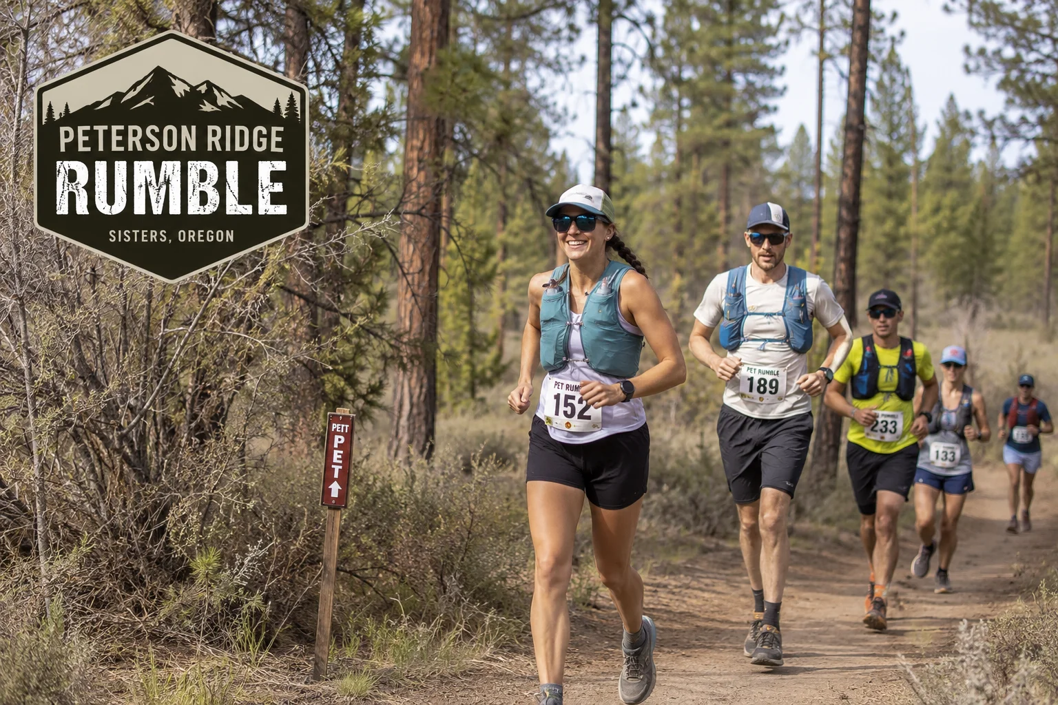
The Peterson Ridge Rumble is an annual trail-running event based around this trail system near Sisters. It runs in April, making it one of the signature spring races on the Central Oregon calendar.
Race distances include a 20-mile and a 50K (31-mile) option, with the course routed through the PRT network on the same singletrack you’ve been exploring all weekend.
We found out about the Rumble after falling hard for the town.
Of course we did.
So now Sisters isn’t just somewhere we want to revisit — it’s somewhere we have a perfectly legitimate reason to return to and run a ridiculous number of miles on a trail we already know we love.
If you’re targeting the Rumble: training on PRT beforehand makes sense. Knowing the trail surface, the junction markers, and how the ladder system works will help you navigate race day and plan your hydration strategy. The Sisters Trails Alliance website carries current race registration and course information.
Dispersed Camping Right at the Trailhead
This is worth knowing if you’re visiting Sisters on a camping trip rather than a hotel stay.
There is dispersed camping on Deschutes National Forest land on Three Creek Road, at the NF-1605/NF-4606 intersection just south of Sisters. Established sites in ponderosa forest, flat ground, looked well-used and legitimate — with the Peterson Ridge Trailhead (and that compost toilet) about a quarter mile north.
Peterson Ridge Dispersed Camping on Trek4Free →
What makes this spot practical:
- Compost toilet nearby — the trailhead a quarter mile north
- Direct PRT access — wake up and run, no driving required
- Five minutes from Sisters — town coffee and food without giving up your campsite
Deschutes NF rules apply: 14-day stay limit, no water on site, pack in pack out, check fire restrictions before arrival. Further south along Three Creek Road toward Three Creek Lake, there are additional dispersed sites with rougher access and more remoteness.
Peterson Ridge Is Multi-Use — Behave Accordingly
PRT is not a runner-only trail.
You’ll share it with mountain bikers, hikers, walkers, dogs and equestrians. Be predictable. Don’t blast around blind corners. Listen for bikes coming from behind. Give horses space and follow the rider’s direction when passing. Keep dogs under control.
Everyone out there came for the same reason you did.
The trail works because people share it reasonably.
Navigation: Download the Map Before You Go
PRT is signed, but it’s a network. Networks create options. Options create wrong turns. Wrong turns create bonus miles.
Sometimes bonus miles are a gift.
Sometimes you have a dinner reservation.
The Sisters Trails Alliance provides route information and downloadable maps, and PRT is well-covered by GPS trail apps. Carry an offline map. Cell signal in the ponderosa forest south of Sisters is not something we’d count on.
Water and the Eastern-Side Heat
Don’t let the trees fool you.
Sisters sits on the drier eastern side of the Cascades. Summer afternoons get warm. The trail is dry. There is no creek to refill from along most of the PRT network.
For a short run (3–5 miles), carry what you normally carry.
For the Overlook route (10.6 miles) or the Long Loop (16 miles): bring more than you think you need. The ponderosa shade helps, but dry heat and mileage still add up fast. LMNT on the drive back to Sisters solved what the shade didn’t.
Mornings are the answer. Start early. Cool air, longer shadows, and the afternoon warmth waiting as a reward when you’re done.
Is Peterson Ridge Worth It If You Aren’t Racing?
Absolutely.
That was our introduction. We weren’t training. We were two travelers who had just discovered Sisters and wanted dirt under our feet before dinner.
We ran a few miles.
Found a trail map on a kiosk board.
Discovered there was a race.
And started planning a return trip before we’d even showered.
The Trek4Free Take
Peterson Ridge isn’t the trail you choose because you need to conquer the highest summit in Oregon.
It’s the trail you choose because you want to run somewhere beautiful from a town you actually like.
Run three miles. Run ten. Run sixteen. Ride it. Walk the dog. Train for the Rumble. Watch the ponderosa forest go past and let the Cascade views show up when you get high enough.
For Tortuga and Polly, PRT became part of the Sisters story within the first hour.
We arrived.
We found dirt.
We ran.
Then we discovered there was a race in April.
Apparently we’ll be back.
Full Sisters, Oregon outdoor guide → | Three Sisters Wilderness hiking →
Free camping near Bend and Sisters → | Trails and events in Oregon →
Before You Go
These are affiliate links — we appreciate your support, no extra cost to you.
Planning Sources
- Peterson Ridge Trails — Sisters Trails Alliance
- Peterson Ridge Overlook — Sisters Trails Alliance
- PRT Long Loop — Sisters Trails Alliance
- Peterson Ridge Rumble — Sisters Trails Alliance
- Current Sisters Area Trails Map — 2026 PDF
- Sisters Ranger District — U.S. Forest Service
- Peterson Ridge on Trailforks
Trailhead: 44.2816°N, 121.5496°W | Peterson Ridge Trail, Deschutes National Forest, Sisters, OR