How to Find Hot Springs, Waterfalls, Caves & Ancient Sites on Public Land
How to Find Hot Springs, Waterfalls, Caves & Ancient Sites on Public Land
The night before we drove the McKenzie River corridor, Polly and I sat in the hotel and opened Trek4Free.
Not a travel blog. Not a podcast tip. The Explore map — filtered for hot springs and waterfalls within range of where we already were. That’s how we found Terwilliger Hot Springs. That’s how we found Sahalie Falls and Koosah Falls a few miles down the road. We had a plan before we went to sleep and executed it the next morning.
That’s the point of Trek4Free. And it’s what makes it different from every other outdoor resource out there.
Most outdoor apps are built around trails and trailheads. They show you where to park and where to walk. What they don’t show you — what almost nothing shows you — is what’s actually on the public land near you. The hot spring sitting in a national forest two canyons over. The waterfall that never made it onto a postcard. The cave you can walk into without a guide. The petroglyph panel that’s been on that canyon wall for a thousand years.
That information exists. It lives in federal databases — BLM, Forest Service, NPS, Army Corps, USGS, OpenStreetMap. Trek4Free pulls it all together onto one filterable map and puts it in front of you before you leave home. No paywall. No subscription. No algorithm showing you sponsored content.
Here’s how each category works and how to use the map to find them.
Hot Springs
Trek4Free aggregates hot spring locations from BLM and Forest Service public land records — geothermally heated pools on or near public land, most of them free or nearly free, most of them completely invisible to anyone using a mainstream app.
Terwilliger Hot Springs near Eugene, Oregon showed up on our Explore search the night before we visited. We knew the location, the access trail, the cost ($12 for two hours), and roughly what to expect before we pulled out of the parking lot. A series of terraced pools from 112°F at the source down to comfortable soaking temperature. One of the better mornings we’ve had on the road — and we found it on Trek4Free, not from anyone’s recommendation.
How to find hot springs: Open the Explore map, hit the Hot Springs filter, and zoom to wherever you’re headed. Each pin links to coordinates, land management notes, and access information. Tap to open in Organic Maps for offline turn-by-turn directions that work without cell service — which matters when you’re on a Forest Service road looking for a spring with no signal.
Browse hot springs near you — Trek4Free shows you what’s within range of wherever you’re headed, not just a state list:
- Hot Springs near Eugene, OR
- Hot Springs near Bend, OR
- Hot Springs near Boise, ID
- Hot Springs near Denver, CO
- Hot Springs near Santa Fe, NM
- Search hot springs anywhere on the Explore map →
One rule that’s non-negotiable: test the temperature before you get in. Geothermal water can reach scalding temperatures. Start at the edges and work toward the source slowly.
Waterfalls
Federal land holds thousands of waterfalls that don’t appear on mainstream apps. They’re in USGS records, Forest Service quad maps, and OpenStreetMap — which is exactly where Trek4Free sources its waterfall data. These are the falls without the parking fees and the railings. The ones where you’re the only person at the overlook.
Sahalie Falls and Koosah Falls on the McKenzie River were both on our Trek4Free search the same night as Terwilliger. A hundred-foot curtain of glacial meltwater into a basalt canyon. Turquoise water. Mist so thick your glasses fog immediately. Connected by a short riverside trail that the McKenzie corridor just hands you for free. We planned the whole morning from the hotel room and walked it exactly as expected.
They weren’t hidden. They were just in the right database, on the right filter, in the right tool.
How to find waterfalls: Open the Explore map and toggle the Waterfalls filter. Zoom your destination and see what falls within a detour of wherever you’re already going.
Trek4Free shows waterfalls near specific cities — not just by state. That’s the difference when you’re planning around where you’ll actually be:
- Waterfalls near Eugene, OR — 86 within 75 miles
- Waterfalls near Asheville, NC
- Waterfalls near Portland, OR
- Waterfalls near Knoxville, TN
- Waterfalls near Denver, CO
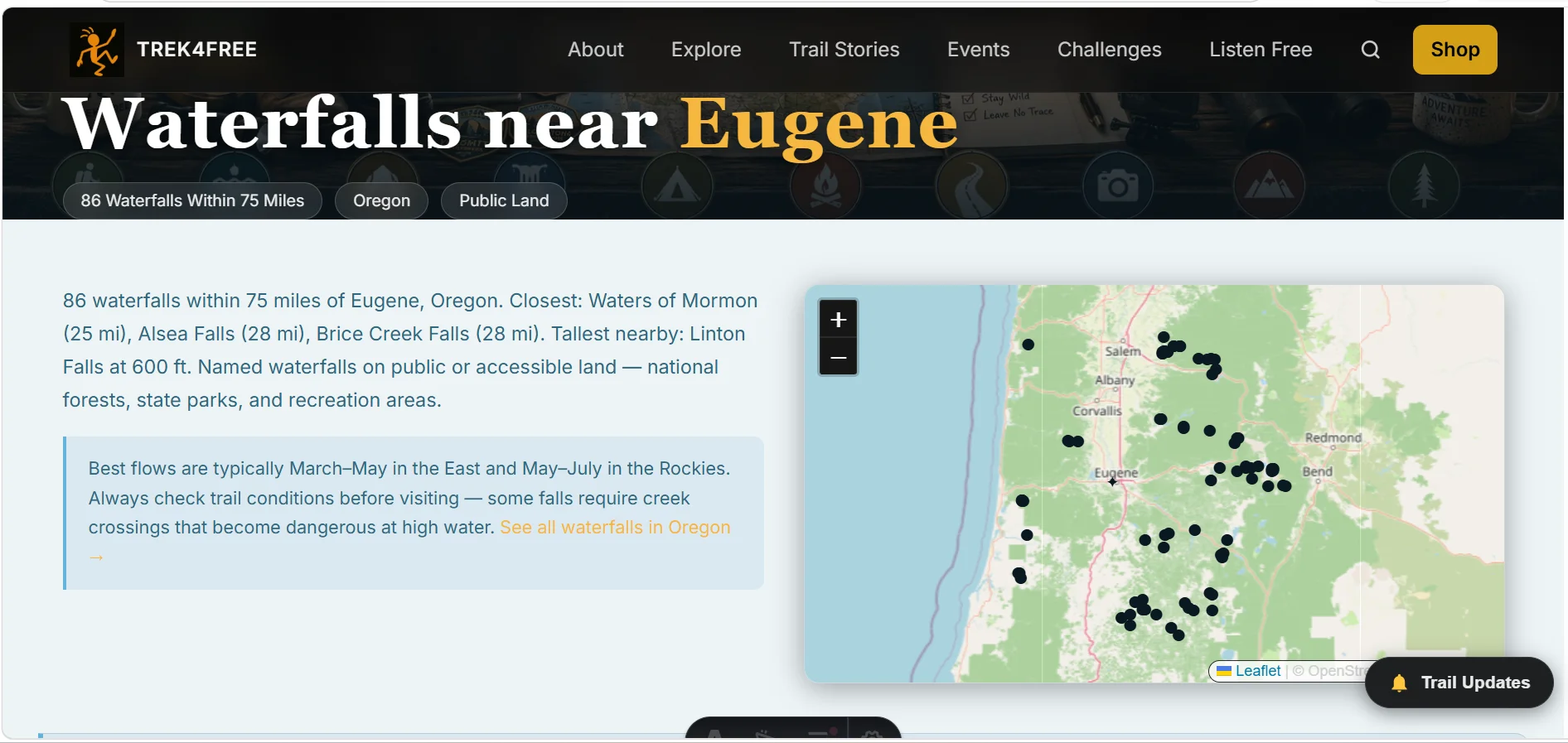
Or open the Explore map and toggle Waterfalls to find them anywhere in the country.
Caves
There’s a category between commercial show caves and technical caving that almost no resource covers: publicly accessible wild caves on federal land that any prepared hiker can enter. Trek4Free documents them from NPS, BLM, and federal land records — caverns with walk-in access, lava tubes, limestone systems, documented natural caves you can visit without a permit.
This is a category that barely exists on any other platform.
Polly’s trail name came from a cave she found and claimed as her own. That’s the thing about caves on public land — they belong to everyone, which means most people walk right past them. The Trek4Free cave database is how you stop walking past them.
How to find caves: Open the Explore map and toggle the Caves filter. Each entry includes what we know about access and land management.
Find caves near where you’re going:
- Caves near Carlsbad, NM
- Caves near Lexington, KY
- Caves near Roanoke, VA
- Caves near San Antonio, TX
- Caves near Eugene, OR
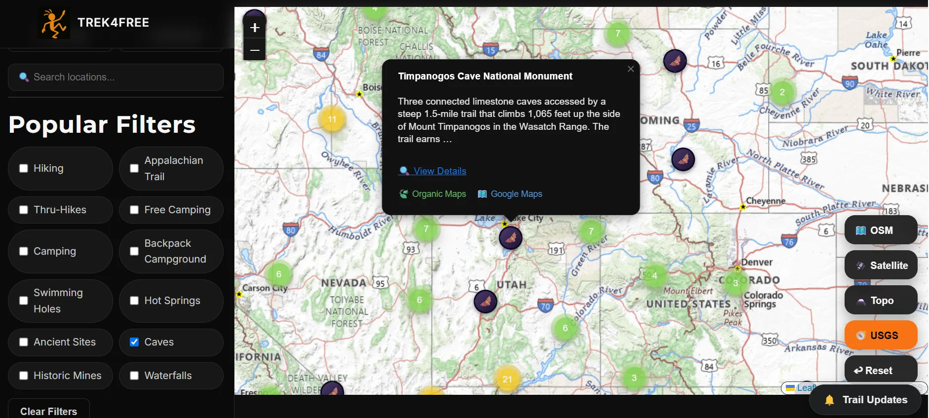
Or open the Explore map and toggle Caves to search any area.
Before entering any wild cave: Tell someone where you’re going. A headlamp with fresh batteries is mandatory — bring a backup. Never enter moving water in a cave. In areas affected by white-nose syndrome, follow posted decontamination protocols for your gear.
Ancient Sites
Public land in America contains thousands of documented archaeological sites — petroglyphs, pictographs, cliff dwellings, ancient mounds, medicine wheels, grinding stones, ruins that predate European contact by a thousand years or more. Most people drive right past them because they don’t appear on any mainstream app.
Trek4Free pulls from federal archaeology databases to map 40 documented ancient sites across 15 states — places that are legally accessible and open for quiet visitation. Standing at a petroglyph panel in the Texas Hill Country with no interpretive sign telling you what to feel about it is one of the more singular experiences public land offers.
The rules are firm: Look. Photograph. Do not touch. Do not remove anything — not a shard, not a stone. The Archaeological Resources Protection Act carries felony penalties for disturbing or removing cultural resources from public land. These sites exist because people before you left them alone.
Find ancient sites near where you’re headed:
- Ancient Sites near San Antonio, TX
- Ancient Sites near Santa Fe, NM
- Ancient Sites near Flagstaff, AZ
- Ancient Sites near Moab, UT
- Ancient Sites near Knoxville, TN
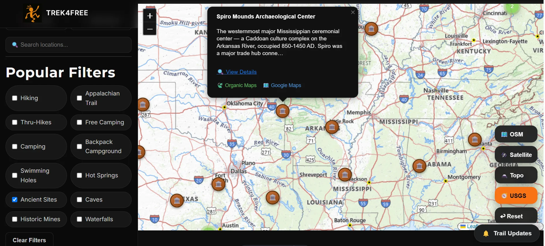
Or open the Explore map and toggle Ancient Sites to search any region.
How to find ancient sites: Open the Explore map and toggle the Ancient Sites filter.
The Explore Map: How It Works
Everything above lives at trek4free.com/explore. One map, one filter bar, four categories — plus free camping, swimming holes, hot springs, historic mines, and more.
The workflow is simple: before you head somewhere, open the map, zoom to your destination, and toggle the filters for whatever you’re looking for. Layer them together — hot springs AND waterfalls AND caves — and see what overlaps near where you’re already going. Every pin connects to Organic Maps for offline navigation.
No other outdoor platform does this. The federal data exists. The aggregation and the free access to it on one map is what Trek4Free built.
There is no app to download. No account to create. No subscription. The whole thing is free, and it works offline once you’ve got Organic Maps on your phone.
Before You Go
As an Amazon Associate, Trek4Free earns from qualifying purchases — at no cost to you. We only link gear we've actually used.
💡 Coast WPH20R Headlamp
Non-negotiable for caves, pre-dawn waterfall hikes, and any backcountry where dark arrives fast. Rechargeable, 400 lumens, 7 hours on medium, IPX4 water resistant. Compact enough to live in the pack permanently. → Check price on Amazon
💧 Sawyer Mini Water Filter
Hot springs and waterfalls both sit downstream of something. The Sawyer Mini screws onto a standard bottle, filters 100,000 gallons before it’s done, and weighs two ounces. Bring it any time you’re near natural water. → Check price on Amazon
💊 Potable Aqua Water Purification Tablets
Backup to the filter — useful when sediment or sulfur content is high. Two tablets per liter, 30 minutes, done. Fits in a shirt pocket. → Check price on Amazon
We planned the whole Oregon morning from a hotel room the night before — hot springs, two waterfalls, the trail connecting them. We knew exactly where we were going before we left.
That’s what the map is for. Open it now and see what’s near wherever you’re headed next.
— Tortuga