The Water You Don't See Coming
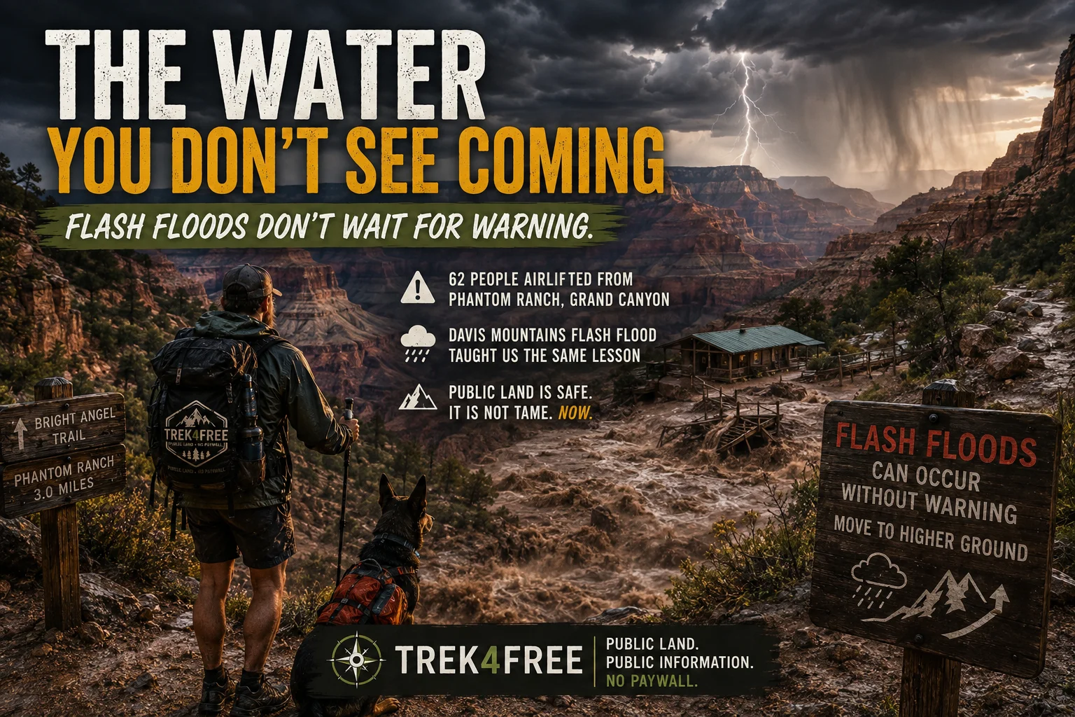
Sixty-two people were just airlifted out of the bottom of the Grand Canyon.
We have a whole article on the trail that leads down there. That’s what makes this one hit different — this isn’t abstract news happening somewhere else. It’s the exact ground we told you about.
What Happened at Phantom Ranch
Flash flooding tore through Bright Angel Canyon starting around 2:30pm on Saturday, fed by monsoon thunderstorms over the North Rim. By Sunday morning, rescuers had airlifted 62 people out of Phantom Ranch and the lower North Kaibab Trail. Nearly every footbridge across Bright Angel Creek was destroyed. The Colorado River is closed to boat traffic — debris and washed-in structures made it unsafe. North Kaibab Trail and Phantom Ranch are closed indefinitely.
No injuries were reported. Everyone made it out. That’s the part worth sitting with as much as the damage.
Here’s what made this flood worse than an ordinary monsoon storm: last year’s Dragon Bravo Fire burned more than 145,000 acres on the North Rim. Burned ground doesn’t absorb rain the way healthy soil does — water sheets off the surface instead, picking up ash and loose rock as it accelerates downhill into the same narrow canyon corridors hikers walk through. A storm that might have been a normal inconvenience became a wall of water instead, because of what happened up top the year before.
If you’ve read our Bright Angel Trail guide, you already know Bright Angel Campground — right at the river — is the classic overnight stop for anyone doing this hike in two days instead of one. That campground is essentially at Phantom Ranch. Anyone following that exact itinerary this weekend was in the flood zone.
This is not the first time we’ve been reminded that moving water in the backcountry doesn’t ask permission first.
”We’re Going Uphill — What’s a Flash Flood Going to Do to Us?”
We were trail running in Davis Mountains State Park, Texas — no cell service anywhere in that park, so no weather alerts, no flood warnings, nothing. It wasn’t raining when we headed out. We were running up into the hills above camp, and we made the kind of logic that feels airtight until it isn’t: we’re climbing away from the creek, not toward it — what’s a flash flood going to do to us up here?
The sky opened up while we were mid-run.
Within minutes, the trail itself — cut into the side of the mountain, cliff dropping away on one side, slope rising on the other — turned into moving water. Not a puddle. A current. It looked less like a hiking trail and more like a whitewater creek you’d run a kayak down, and we genuinely could not see where the trail was underneath it anymore. We knew our boundaries only because the terrain gave us no other option: cliff on one side, hillside on the other, water in between.
We were standing in what is, by any normal description, a desert. On top of what we’ll generously call a mountain and more honestly call a big hill. And we could not figure out where that much water was possibly coming from.
The answer is the same principle behind what just happened at the Grand Canyon: thin, rocky desert soil doesn’t absorb rain — it sheds it. And a trail cut into a slope is very often the lowest, most natural drainage line on that hillside, whether anyone designed it that way or not. When a monsoon cell opens up overhead, the trail doesn’t just get wet. It becomes the drainage.
We got off that mountain and back to camp. That’s when we learned the danger wasn’t just above us — it was already at the campground.
The Radio Call
Park rangers were running an active emergency evacuation by radio, moving campers to higher ground at the Indian Lodge, well above the creek. Not everyone could get out. A low-water crossing was the only way in or out of one of the campground loops, and it had already flooded — campers on the far side of it were simply stuck, cut off until the water dropped.
The day before, we were told, two young boys had been playing in that same creek when a wall of water — ten feet tall, carrying trees — came down without warning. A neighboring camper started screaming at them to get out. They barely made it. The water hit them hard enough to rip a shoe clean off one of them. They survived. It could easily have gone the other way.
We made it to Indian Lodge — higher elevation, and the only spot in the park with any cell signal — and our phones lit up with flood warnings and emergency alerts all at once. That’s when we understood the same storm system that had just turned our own trail into a river was, that same night, causing one of the worst flooding disasters in recent Texas history, in and around Kerrville, not far from where we stood.
We watched the water climb toward the highway bridge and genuinely wondered if the main road out of the park was about to go under too.
We were fine. We were lucky, and once we were back within reach of people whose job is to know these things, we listened. Not everyone that night was as fortunate.
The Lesson, Twice Confirmed
“Uphill” is not the same thing as “safe.” We learned that one directly — the water didn’t rise up to meet us from some creek below, it fell out of the sky onto the exact trail we were standing on and turned it into the fastest way down the mountain. Elevation doesn’t protect you from a storm that’s forming directly over your head. Desert soil especially can’t absorb a downpour fast enough to keep it from finding the lowest path on the slope — which is very often the trail itself.
And even a real warning system has a geography problem. Davis Mountains rangers were on the radio, actively evacuating people to higher ground, and it still wasn’t enough for everyone — a single low-water crossing was the only way out of one campground loop, and once it flooded, the people on the far side of it were stuck no matter how fast the warning reached them. Knowing the danger and being able to physically outrun it are two different things.
In a dead zone — no cell service, no weather radio — your best chance is a person who already knows, telling you to move, before the ground between you and safety disappears. Sixty-two people at the Grand Canyon just lived a version of that same race and won it, walking away unhurt. That’s the best possible outcome from a genuinely dangerous situation.
Public land is safe. It is not tame. Both of those things are true at once, and it’s worth carrying that with you every time you’re standing near water — or a dry trail — that you can’t fully see the source of.
Grand Canyon National Park’s official updates on trail and facility closures are posted at nps.gov/grca. If you’re heading into terrain with no cell coverage, know your evacuation routes and higher ground before you need them — not after.