Young Washington — The Boy Who Carved His Name 23 Feet Up
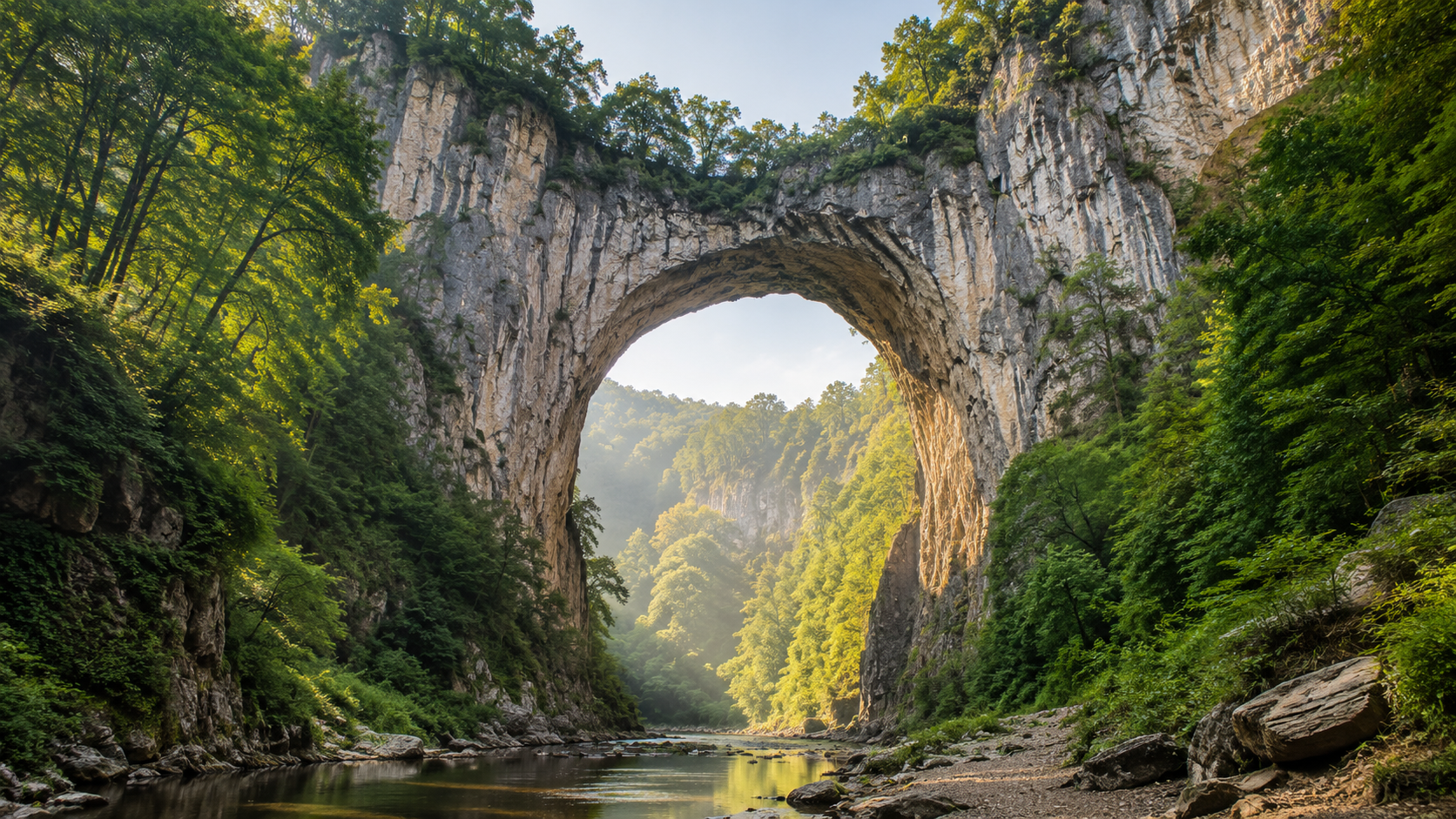
The limestone face rose 215 feet above Cedar Creek. Something had carved through the mountain over millions of years — water, the patient kind that does not hurry — and left behind an arch that looked impossible. The Monacan people who had lived in these mountains for thousands of years called it the Bridge of God.
A 16-year-old from the Tidewater stood at the base, looked at the cliff wall, and saw the names carved there. Names going up the rock face. Each one a little higher than the last.
He was six feet two inches tall. He picked up a chisel and started climbing.
Before the General
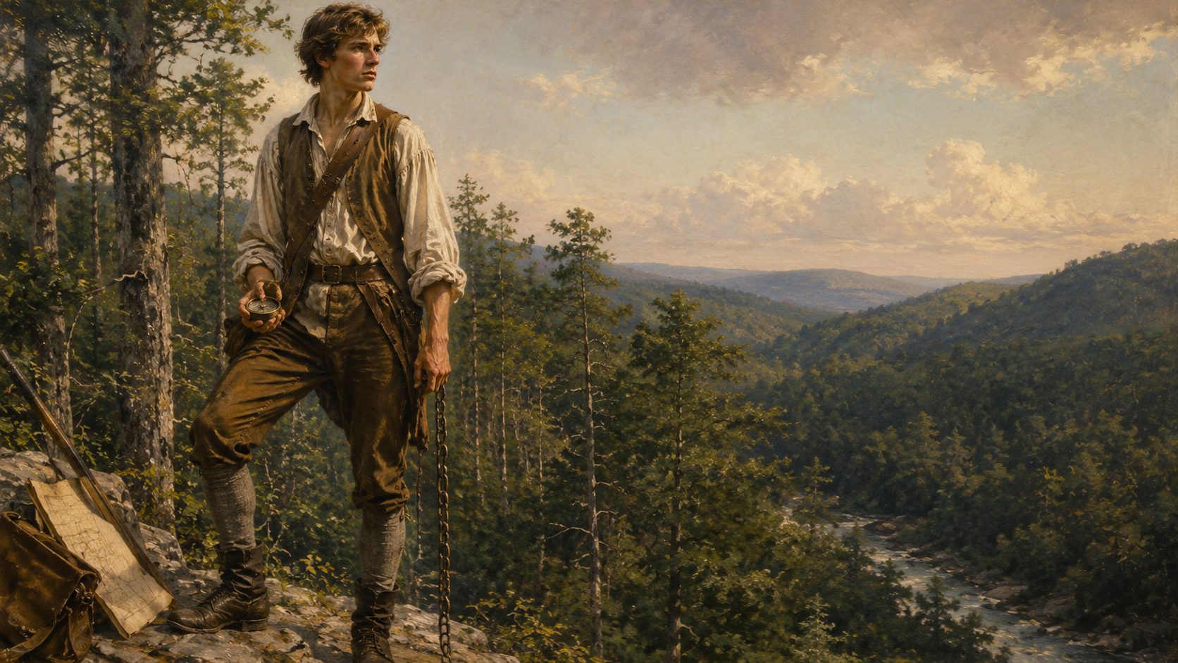
This is not the man who crossed the Delaware. This is not the president who could not tell a lie. This is a lanky teenager from a family that had lost its patriarch when he was eleven — a boy who inherited a compass instead of a college education, and who had just accepted his first real job.
Cross the Blue Ridge Mountains. Map what nobody has mapped. Figure out what five million acres of Virginia frontier actually looks like.
His name was George Washington. He was sixteen years old. He was about to spend the next several months sleeping under what he described in his own journal as one thread bear blanket with double its weight of vermin such as Lice Fleas &c.
It reads a little rough because it IS rough — a 16-year-old complaining about his lice blanket in his own words, spelled the way he spelled it.
He loved every minute of it.
The Richest Man in Virginia
Lord Thomas Fairfax, 6th Baron Fairfax of Cameron, owned approximately five million acres of northern Virginia and the Shenandoah Valley. He had a deed to all of it and had personally seen almost none of it. He needed someone to go out there with a compass and a transit and figure out what he actually owned — where the rivers ran, where the ridgelines fell, what the boundaries were on the ground versus what they were on paper.
His cousin introduced him to the Washington family.
George was not quite seventeen. He had been practicing surveying on the family farm since he was thirteen — methodical, precise work, the kind that rewards patience and punishes guessing. Fairfax offered him the job.
The pay was seven shillings, three pence per day.
Washington said yes before the sentence was finished.
Crossing the Ridge
March 1748. Washington set out across the Blue Ridge with James Genn, the county surveyor, and two others. His diary starts immediately — observations on weather, terrain, river crossings, the quality of the men he was working with. The diary of a future general starts like a professional field report. Except the writer is a teenager, and occasionally he cannot help himself.
On the crossing, a mattress they were sleeping on turned out to be full of lice and they threw it in the fire. Washington’s journal records this with what can only be described as amused resignation.
They swam horses across the swollen Shenandoah in spring flood. They slept in barns when they could find them and in the open when they couldn’t. They ate by fire and woke stiff and went back to work.
He was in the mountains for weeks. He surveyed tracts, drove stakes, recorded bearings with precision that still holds up today. He was also, for the first time in his life, somewhere that matched the size of whatever was already inside him.
He came back from the mountains and did it again the following year. And the year after that.
The Bridge of God
Natural Bridge is not a trail destination. It is a hole through a mountain.
Cedar Creek carved it — the same creek that flows beneath it today, cold and clear from the limestone aquifer. Over millions of years the water found a weakness in the rock and went through rather than around. What it left behind is a limestone arch 215 feet high and 90 feet wide at the span. Large enough to carry a road across its top. Large enough that when Thomas Jefferson later bought it — twenty-six years after Washington stood there — he built a small cabin nearby and hosted guests. He called it the most sublime of Nature’s works, and he had seen a great deal of nature.
The Monacan people, whose homeland these mountains were long before any English lord had a deed to them, had another name for it. Bridge of God. They had been there for thousands of years when the surveyors arrived. They were still there.
Washington came through these mountains in the course of his work for Fairfax. What is preserved — not in any journal, but in the limestone itself — is what happened when he saw the cliff wall below the arch and the names carved into it by everyone who had come before him.
The Initials
The tradition was simple: you came, you carved your name. Visitors had been marking themselves into the limestone for years. The cliff face recorded who had been there and how high they had dared to reach.
Washington looked at those names and picked up a chisel.
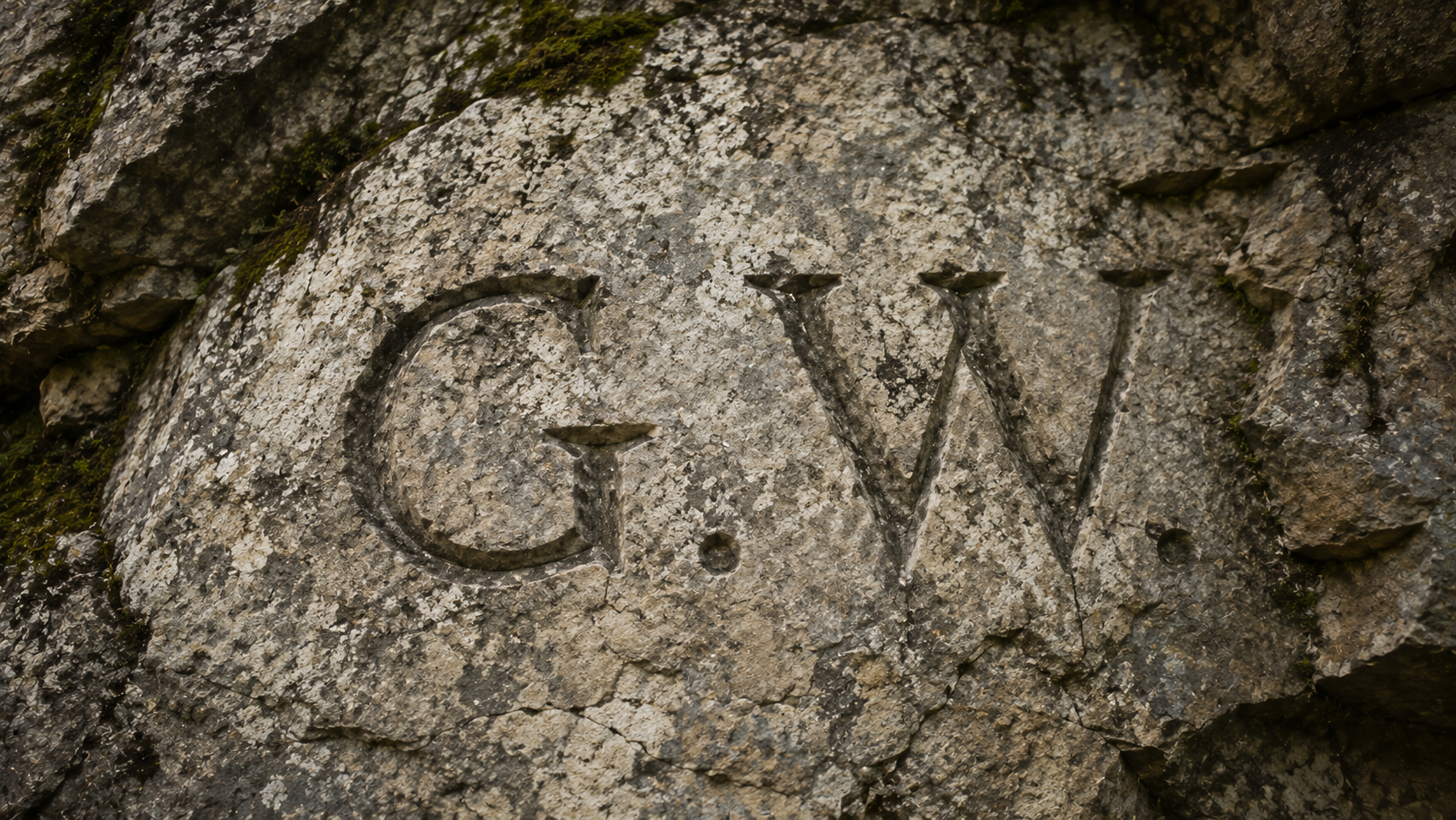
He was six feet two inches tall, which in 1748 was an unusual thing to be. He carved his initials 23 feet up the wall. Higher than anyone else had managed. Higher than anyone else would manage for a long time after.
The G.W. is still there today.
This is the detail that tells you who he was before history told you who he was. Not in a great battle. Not at a moment of national consequence. Standing alone at the base of a cliff in the Virginia wilderness at sixteen, looking at a wall of names, and deciding to go higher than everyone else because he could.
That is not a small thing. That is a man at the beginning of himself.
What’s Below the Bridge
Cedar Creek carved more than the arch. The limestone beneath Natural Bridge is riddled with passages — the same patient water that punched through the mountain left cave systems in its wake. Those caves held saltpeter, the potassium nitrate compound that is one of the three essential ingredients in black powder.
When the Revolution came — the same revolution that 16-year-old Washington standing at this cliff could not have imagined — the caves beneath Natural Bridge became important. Saltpeter mining supplied gunpowder to the Continental Army. The mountain he had surveyed and climbed as a teenager became, a generation later, part of the industrial supply chain of the war he would lead.
He could not have known any of that. He was just looking at a good cave.
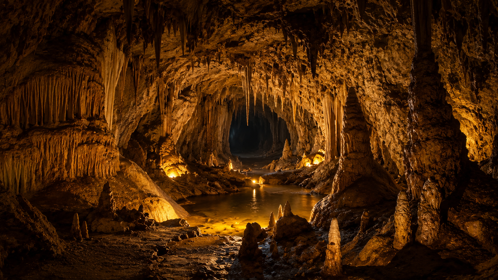
The caverns are worth going into if you get the chance. Limestone formations, the cold of deep rock, the drip of water that has been dripping for longer than the country has existed. The same dark Washington would have held a torch into. The connection is not metaphorical — it is geological. Same stone. Same mountain.
The entire Shenandoah Valley sits on limestone, and the caves run through all of it. Grand Caverns, about 40 miles north near Grottoes, Virginia, is the oldest cave open to the public in the United States — first opened to visitors in 1806, reportedly visited by Thomas Jefferson, and used as shelter by soldiers from both the Union and Confederate armies during the Civil War. Those soldiers scratched their names, dates, and unit designations into the calcite walls. They are still legible today. A different kind of initials in stone — same impulse, same valley, different century.
The Through-Line
Washington did not have a car to retreat to. When his blanket was full of lice and the Shenandoah was flooding its banks in March, he forded it and kept working. When conditions changed, his only option was to get better at reading conditions. The mountains were not safe. He went into them anyway. He went back the next year. That is a different kind of preparation than anything you can buy at REI.
Washington surveyed Virginia’s frontier from roughly 1748 to 1752. He learned to read terrain the way a general has to read it — not as an abstraction on a map but as a physical reality with ridgelines and water sources and sight lines and mud and cold. The mountains taught him things no school in England could have.
At twenty-two he commanded Virginia militia in the French and Indian War. He made mistakes and learned from them. He survived engagements he probably should not have survived. He came home and married and ran a farm and sat in the legislature and waited for what came next.
What came next was the Revolution.
In the winter of 1776, with the Continental Army in collapse and everything at stake, General Washington crossed the Delaware in a snowstorm in the middle of the night and attacked Trenton at dawn. The British commander, caught completely off guard, surrendered within an hour.
The general who made that call, in that moment, with that level of cold certainty — was the same person who had climbed a limestone cliff in Virginia at sixteen for no reason except that he wanted to go higher than everyone else.
That is not an accident of personality. It is the same person, thirty years later, doing the same thing.
Go There
Natural Bridge State Park is in Lexington, Virginia — western edge of the Shenandoah Valley, Blue Ridge Mountains on the east, Allegheny Mountains on the west.
The bridge is a short walk from the visitor center along Cedar Creek trail. You will walk under 215 feet of limestone arch and the creek will be cold and the rock will be exactly as old as it looks. The G.W. initials are on the wall.
The Monacan Indian Village at the site is a living history exhibit — the descendants of the people who were here thousands of years before Fairfax had a deed or Washington had a compass. Worth your time.
Check current tour availability for the caverns and seasonal hours directly through the state park before you go.
Virginia State Parks — Natural Bridge
If you’re coming from the Appalachian Trail: Natural Bridge is about 25 miles west of the trail corridor in this section. Worthwhile detour if you have a car. The Roanoke Triple Crown — McAfee Knob, Dragon’s Tooth, Tinker Cliffs — is about 30 miles northeast and worth building a weekend around. Trek4Free has a Roanoke Triple Crown challenge if you want to earn the badge.
The wilderness did not produce George Washington. He was already whatever he was going to be when he walked into it. What the mountains gave him was room to find out.
Five million acres. An unmapped valley. A blanket full of lice. Enough time alone to understand that he was not afraid of any of it.
He was sixteen. He carved his initials higher than everyone else.
Then he went home and came back the next year.
Natural Bridge State Park, Lexington, Virginia. Cedar Creek trail, the G.W. initials, Monacan Indian Village, limestone caverns. Shenandoah Valley, Blue Ridge, public land. Go find it.
A Note from Tortuga
I have been far enough off-grid to know what it feels like when the conditions change and there is no easy way back.
I was running backcountry once, cold and dry, moving well. My foot went through the snow into a creek hidden underneath — a stream I had no idea was there. My foot was soaked instantly. In cold backcountry, wet feet are not a problem. They are the beginning of a problem. I turned around and retreated to shelter. That is the right call and I knew it and I made it. But the moment still stays with me — the way the ground gave way, the way everything shifted in an instant, the way comfortable became dangerous between one step and the next.
I have also been fifty miles from a paved road with a car that would not start. That is a different kind of fear. Cold and mechanical and patient. It waited me out until I figured it out. I did. But I sat with it for a while first.
I tell you both of these stories because George Washington did not have the option I had. No car. No trail back to a parking lot. No cell signal to call anyone even if there had been someone to call. When the Shenandoah flooded in March and the blanket was full of lice and the next survey stake was on the other side of that river — his options were ford it or quit. He forded it. He was sixteen years old.
That impresses me more than anything that came after.
I think about those initials a lot. G.W. — carved 23 feet up a limestone wall in the Virginia wilderness by a boy. In today’s terms he was a junior in high school. A kid. Not a general. Not a president. Not a legend. Just a tall teenager who looked at a wall of names and decided to go higher than everyone else because he could.
He did not know what he would become. He was just out there in the mountains, doing the work, seeing how far up the wall he could reach.
I think that is the whole story. Everything else is just what happened next.
— Tortuga